

Data Collection
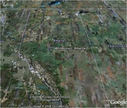
This project was
conducted on the Freeman River and Sakwatamau River drainages near
Whitecourt, Alberta. This area was selected because 1)the extensive
amount of industrial development and stream crossing networks
2)historically diverse fish communities that occurred in the area.
Using ArcGIS, stream crossing sampling sites occurred every time a road
and stream intersected.
A culvert inventory and
assessment was conducted for both study watersheds to determine the
physical characteristics and fish passage parameters of each crossing
structure (culvert or bridge). For more detailed information see the
Foothills Stream Crossing Inspections Manual (McClearyet al.
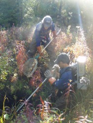
2006) Additionally, we took habitat data to further characterize the
stream width and depth, substrate, and water chemistry. Finally, if the
stream was wadeable, we electrofished 300m downstream followed by 300m
upstream of the crossing to quantify stream fish assemblages. Sampling
entire watersheds will allow us to gain a complete picture of stream
crossing networks and fish communities in the area.
Data Table
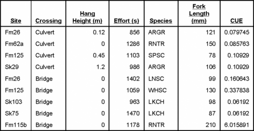
In this study, the predictor
variables will be outlet hang height. Bridge crossings will be used as
a control as no hang height is present. The response variable will be
fish species and catch per unit effort (#fish/s) (CUE). Both the
predictor and response variables are continuous data that was observed
in the field at the date of sampling.