 |
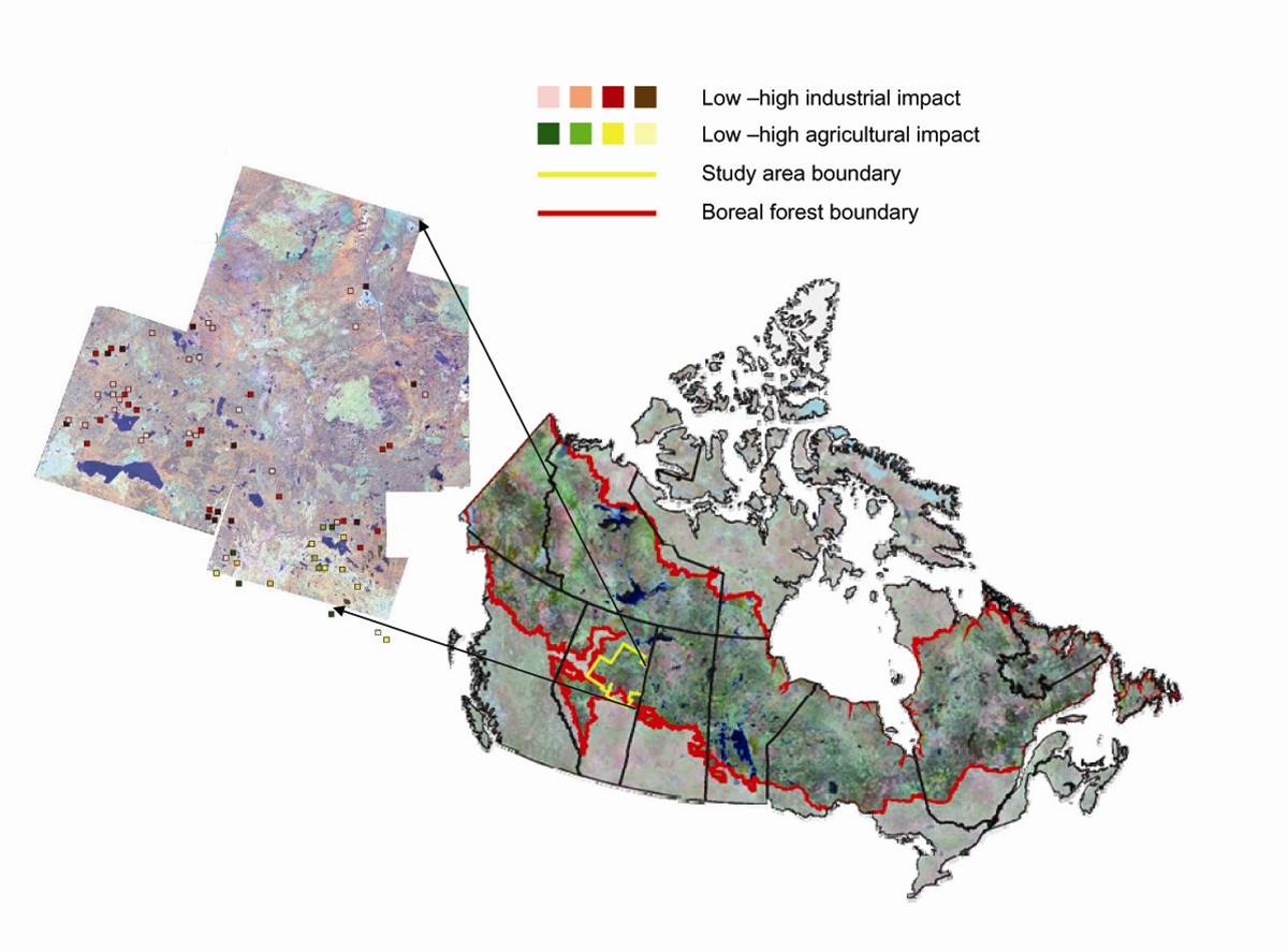
| Fig. 2a. The study area encompasses 115,000 km2 of northeastern Alberta in boreal plains ecoregion. This area is characterized by a primarily sub-humid ecoclimate with a mean summer temperature of 13-15 degrees Celsius. Dominant tree species include trembling aspen, balsam poplar with white spruce and balsam fir occurring in late succession (Source: Ecological Framework of Canada). Wetland types classified according to the Canadian Wetland Classification System include a broad range of classes from graminoid dominated wetlands to treed wetlands. These together with open water ponds and lakes can comprise a substantial proportion of the landscape. |
 |
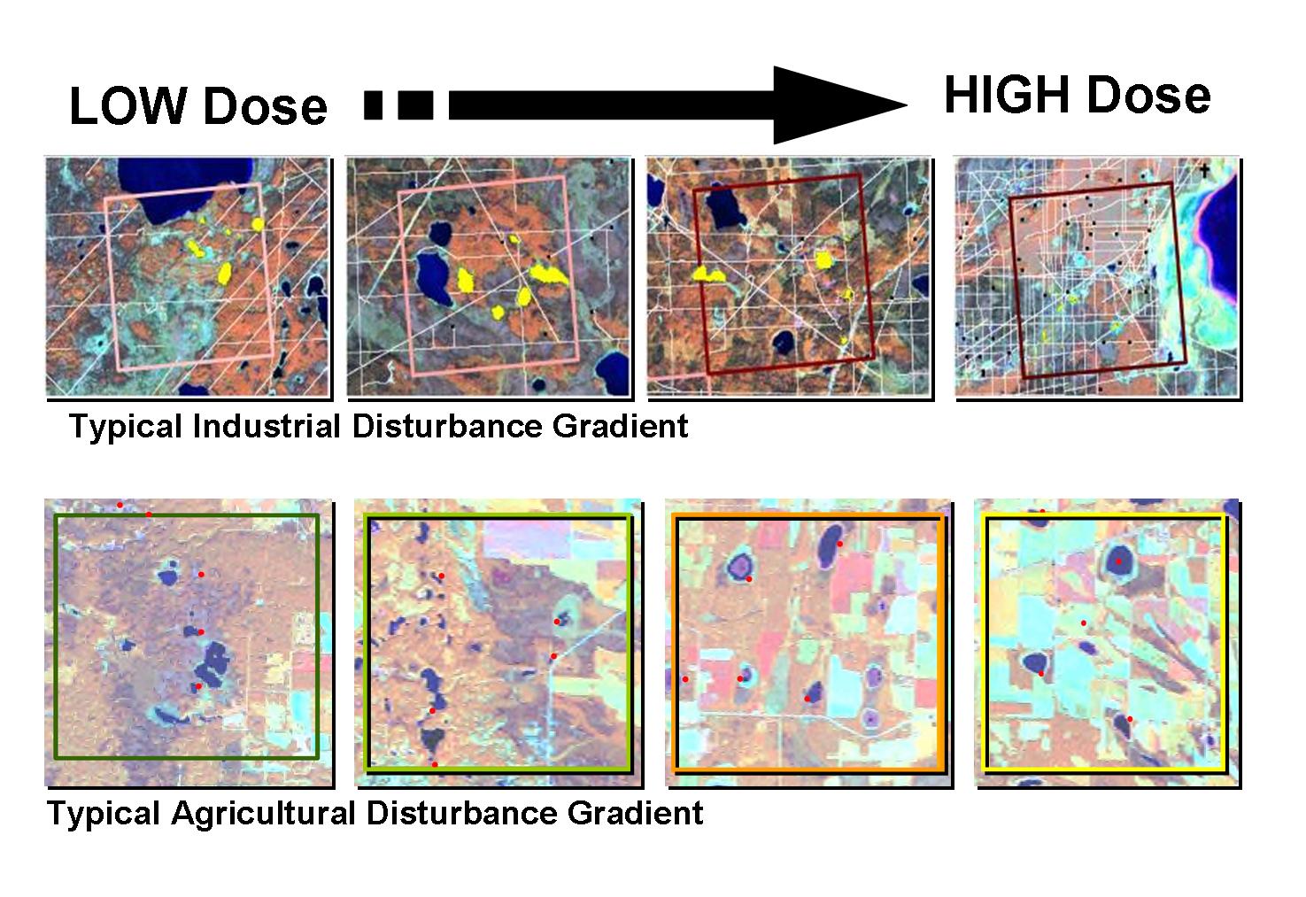
| Fig. 2b. Sites were
selected along a gradient of low to high disturbance. A roving window analysis
was applied at the 25 km2 scale. For each block the total amount
of each disturbance was calculated. Disturbances included roads, seismic
lines, pipelines, hydro lines, railways, forest harvesting and agriculture.
See Cumulative Effects Index in Secondary
Analysis. To be eligible each block had to have at least 5 wetlands
of 1-25 ha in size. To reduce variability caused by landscape forest composition,
only blocks that were or had been dominated by at least 40% deciduous or
mixedwood upland cover were selected. |