Alberta Seed Source Selection Tool (Alberta3ST)
Alpha version, Feb. 15, 2020, by Zihaohan Sang ✉ and Andreas Hamann ✉.
Home | Instructions
Instructions
You can launch the tool by selecting a target region for reforestation from the list of Alberta breeding regions below. (If you want to explore the functionality of the tool, start with Region D or Region I as there are many tested seed sources from across Canada for these planting regions).
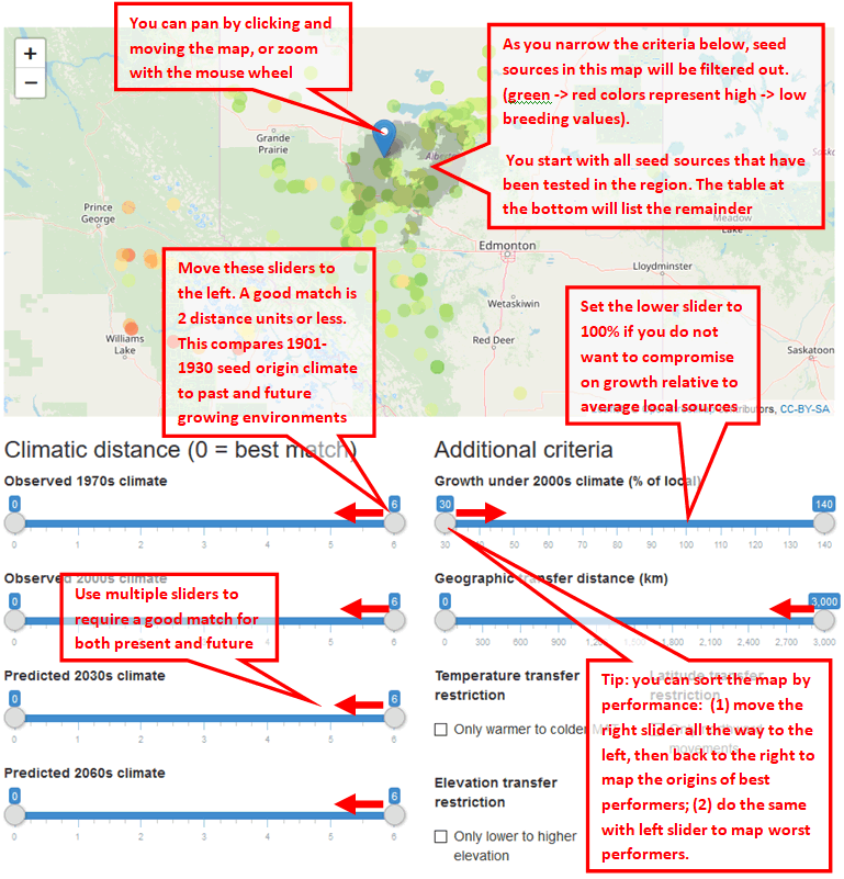
Alberta3ST displays a map showing your selected region for reforestation and potential seed sources. You can pan and zoom with the mouse wheel. The chosen region is indicated with a blue marker, and if you zoom into this area, you will see the mapped region represented by gray shading.
By default, the map also shows all seed sources that have been tested in the region as coloured dots. Dark green seed sources are the highest growth performers in your chosen region under 2000s climate conditions. Dark red seed sources are the poorest performers. No selection criteria have been applied to the default map.
The slider tools below the map allow you to change criteria for seed selection such as climatic similarity of seed source and planting site, geographical transfer distance, etc. As you change these parameters, the map updates automatically, allowing you to view the impact of your choices on potential seed sources.
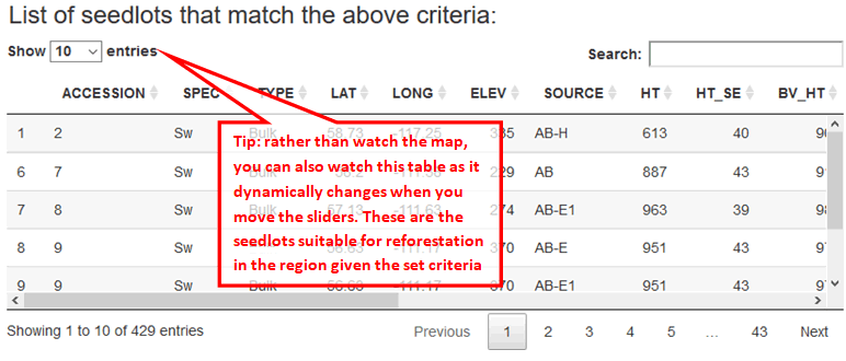
At the bottom of the page, you can find a table containing details of seed sources shown in the map. This table also dynamically updates as you move the sliders. You can sort the table by clicking on the headers.
Get started
Select a target region in Alberta for reforestation:
Region D | Region D1 | Region E | Region E1 | Region E2 | Region G1 | Region G2 | Region H | Region I

This work is licensed under a Creative Commons Attribution-NonCommercial-ShareAlike 4.0 International License.