Since 1994 MT exploration has been used to study the crustal structure of the San Andreas Fault in Central California. The goal of the survey was to study the fluid distribution in the fault zone at depth to determine how it is related to the seismic behaviour of the fault.
The seismic behaviour of the San Andreas Fault varies dramatically with location. The Northern and Southern segments are locked and have not experienced a major earthquake since 1906 and 1857 respectively. In contrast the central segment from San Juan Bautista to Parkfield undergoes continuous creep.

Carrizo Plain - locked segment
The Southern segment of the SanAndreas Fault has been locked since the 1857 Fort Tejon earthquake. At Carrizo Plains the San Andreas Fault exhibits a number of offset creeks, as shown above. A continuous MT profile was collected here in 1994 and details of the survey results at Carrizo Plains
Parkfield - transition from locked to creeping
At Parkfield the fault changes from being locked to creeping. It is also the location of a series of characteristic M = 6 earthquakes. An initial survey in 1994 showed that the fault zone was characterized by a zone of low resistivity that extended to a depth of 3 km. This survey provided important site characterization information for the SAFOD project.
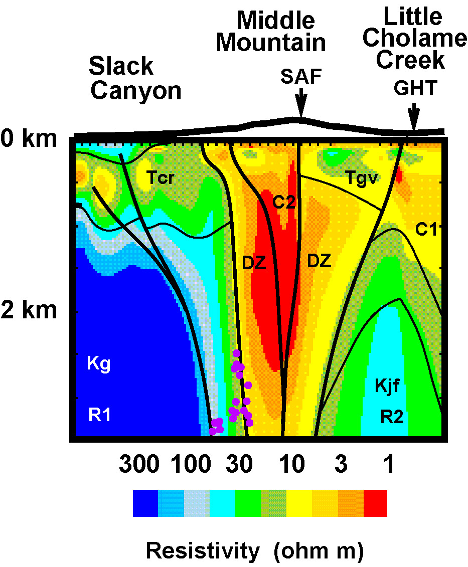
A more extensive survey in 1997 extended the survey and added addition transects. Results described by Unsworth and Bedrosian, 2004
Hollister - creeping segment
At Hollister the San Andreas Fault creeps and no earthquakes larger than M=5 have been observed. In 1999 MT profiles were recorded at two locations. The first was at Paicines and the second in Bear Valley. Inversion of MT data showed that a low resistivity zone extended to more than 5 km and was coincident with a seismic low velcoity zone. Details in Bedrosian et al., (2004)Last updated April 2009
Back to the Tectonics research page