

The Kastro Kallithea rchaeological Project
Context and Location
Research
The City Plan
Fortifications
Agora
Domestic Space
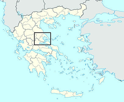

Located in central Greece, Thessaly consists of four large fertile plains which, in Antiquity, were referred to as ‘Tetrads.’ From the Early Neolithic period onwards, these plains were used intensively for cultivation of cereals and raising livestock.
The four plains are surrounded by areas of higher elevation and rolling hills. These were known in Antiquity as 'Perioikoi'. Achaia Phthiotis, the region in which Kastro Kallithea is situated, is such a perioikos. Achaia Phthiotis represents the utmost south eastern part of Thessaly.
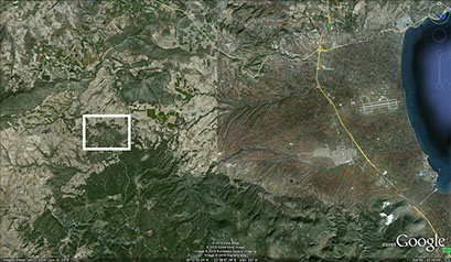
The 618 m. high hill on which the site is located is a dominant feature of the region’s topography and closes off the western side of the coastal plain of Almiros, in Antiquity known as the 'Krokian Plain.' The summit provides a commanding view of the surrounding landscape and as such controls an important ancient transport route from inland Thessaly to the coast. The modern village of Kallithea is situated at the western foot of the hill and the river Enipeus flows on its eastern side.
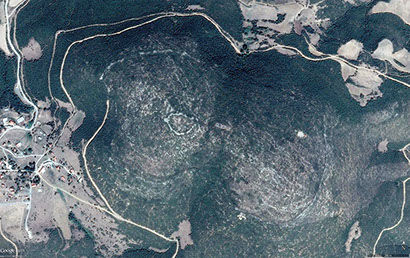
The ancient fortifications and the city plan are easily visible in the satellite photographs of Google Earth.
Urban Survey
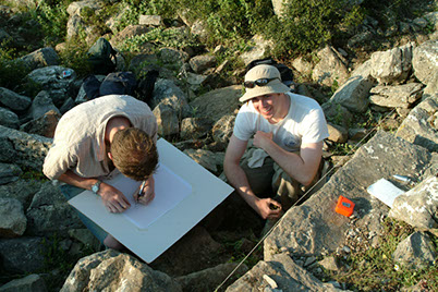
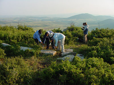
The Kallithea project has progressed through several stages of research. The initial prospection of the site involved surface survey, architectural survey and the measurement of all architectural features using GIS (Geographical Information System).
The urban surface survey (2004-2009) involved systematically observing and collecting surface finds throughout the site relative to units measuring 20 by 20m. The analysis of the assembled material has been finalized as part of the dissertation of Laura Surtees. By analyzing the finds in detail, she was able to establish variation in occupation range and function over different areas of the city.
In addition, architectural survey teams recorded and mapped numerous visible structures including the site’s gates, several buildings suspected to be housing units, a typical tower, and public buildings in the site’s central area.
These methods allowed the completion of detailed maps outlining existent remains while providing an opportunity to study construction techniques utilized at Kallithea and contextualizing the results of the surface survey.
Both surveys made it possible to distinguish areas within the city with different purposes. The agora area (market place) functioned as the city’s economic, political and religious centre. The main housing area was located on the eastern slope of the site. Some workshops could be recognized as well, such as a smithy near the easternmost summit of the site.
GIS has been an important component of the research methodology. Based around various traverses, we have measured in several thousand points with our Total Station which include basic topological shots, architectural features such as walls and buildings, find locations, and excavation depths.
Excavations
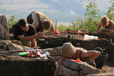
From 2007 onwards, the team conducted excavation at Kastro Kallithea. Excavation is a slow process but it adds much detail to the information gained by the other methods utilized during the urban survey.
In 2006 several 1 by 1m test trenches were dug in various areas within the city. This yielded important new information on the stratigraphy and dating of the site. The team conducted full excavations of Building1 (a stoa), Building 5 (a small temple) and Building 10 (a domestic structure).
Excavation is often a balancing act in which time limits and finances need to be weighed against meticulousness and safety issues. The remoteness of our site means that all excavation and removal of large building stones and other debris had to be done by hand.
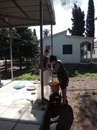
Excavation is destructive work and information can be lost permanently if finds and observations are not properly documented. The team members kept a journal of their daily activities, so that initial thoughts and considerations were preserved. In addition, the trench supervisors wrote digital day reports. The location and depth of artefacts and ecofacts were recorded with the Total Station and drawings were made of each excavation level. Baulks were left in designated areas so that the vertical information, the stratigraphy, of each excavation unit could be verified. Many soil samples were taken and 'flotted' in order to retrieve the microfaunal and microbotanical remains.
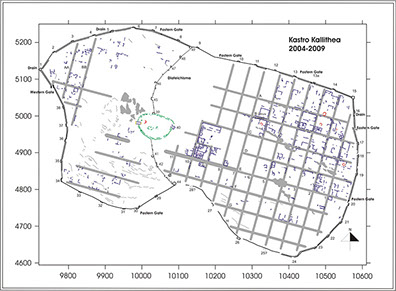
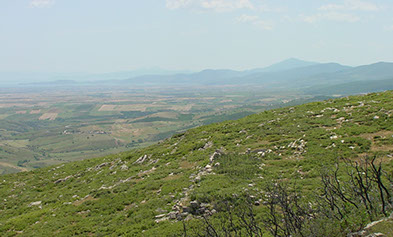
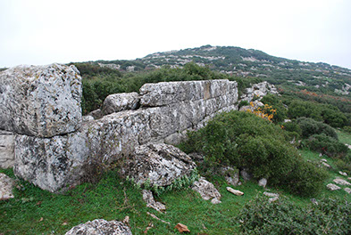
The ancient city is located on the summit of a 618m high hill with two hilltops, near the present day village of Kallithea. Its surface area as demarcated by its city walls is 34 hectares. The eastern top is occupied by an acropolis which dates to the Late Classical period (4th century BCE). This is earlier than the more extensive fortifications and the regular city plan which likely date to the early 3rd century BCE.
The site is locally known by its modern name: Kastro (Greek for fortified place). We do not know the city’s ancient name. Written sources are rather silent regarding this region with the exception of two inscriptions found at Delphi which record a territorial conflict between four cities in this area. It may well be that our site is Peuma, one of the cities mentioned in these inscriptions. This city is also known to have minted coins. Only one of the ca. 60 coins found thus far at our site is from Peuma. No inscriptions are found at the site supporting this identification.
The survey and excavations have pointed out that the Kastro at Kallithea was constructed in several stages. The oldest part of the site is the fortified round acropolis which probably dates to the 4th century BCE which may have had a surrounding settlement. It may have initially functioned as a fortress controlling the east-west route between Pharsalos and the coast.
In the late 4th/early 3rd century BCE the site became significantly enlarged by the addition of extensive fortifications and the lay-out of a grid-like city plan including a market place (agora) and housing area. Both these fortifications and the city plan must have been conceived as one whole, as streets line up with some of the defensive structures and because almost all streets and structures on the site have the same orientation.
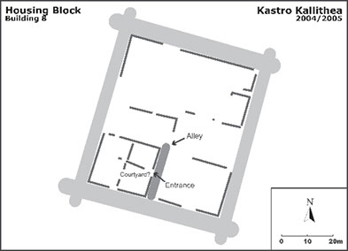
At least 13 streets and 8 avenues cross each other and demarcate similarly sized housing blocks of 38.5 x 45 m. The site was not completely occupied by architectural structures; some areas may have been deliberately left open to provide space for flocks of cattle, goats and sheep.
The main housing area can be found on the north eastern slope of the hill and habitation may also have extended to the area west of the internal fortifications (diateichismata). We estimate that about 1000 people lived in the city.
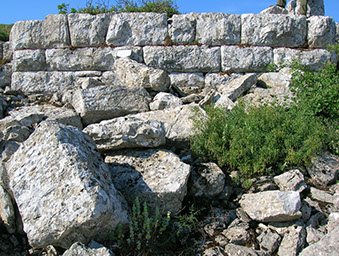
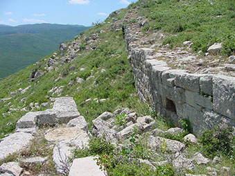
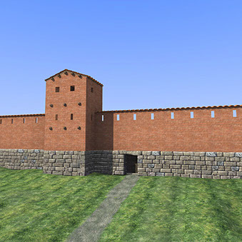
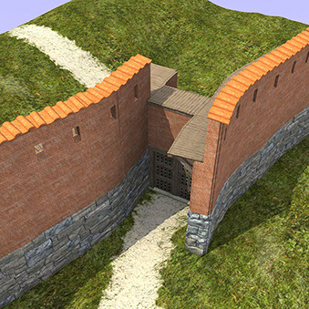
Due to the development of siege tactics in the course of the 4th century BCE, Greek cities of any size increasingly had to rely on their walls, or enceinte, to ward off threats from opposing armies. At Kastro Kallithea tactically beneficial terrain was combined with an extensive defensive system.
The major components of this defensive system are:
The external fortifications with a total length of 2.4km
Two inner defensive walls, or diateichismata
Two major gates at the east and west sides of the city
Forty nine towers and five postern gates
A city’s enceinte was comprised of two key elements: the curtain wall and the towers. As siege technology developed in the last half of the 4th century BCE, towers started to house defensive engines, like catapults. Kastro Kallithea’s towers are on average 6.7m wide by 4.5m deep. A mud brick superstructure was laid on top the stone foundation courses. The stone foundations have been preserved up to 2.5m high in some areas.
The two large gates allowed entry into Kallithea at the east and west ends of the city. They are variations of so-called Type II gates, openings created by overlapping segments of the wall. The western gate is the heavier constructed of the two as it includes a gate chamber and may have had two doors.
Two inner walls, diateichismata, served as an emergency last point of defense. In case of a breach at the West Gate, the more vulnerable of the two gates, defenders could retreat to the acropolis and inner walls in order to protect the eastern part of the city.
Postern gates were smaller openings in the wall which were used for either active defense or domestic purposes. At Kallithea there are five posterns. Their relative rarity at Kastro Kallithea as well as their proximity to springs suggest that they merely facilitated access to water for the inhabitants and their animals without compromising their safety.
The 3D reconstructions were made by Ryan Lee.
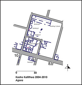
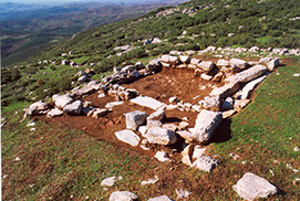
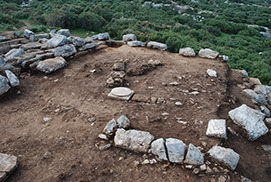
The area in the saddle between the two hilltops functioned as the agora; the city`s economic, political and religious centre. The agora area was bound by streets 8 and 10 and avenues C and E. Several large structures were discovered here which differ from buildings in the housing area. Their larger size and higher quality of construction suggest a public function.
On the north side the agora is bounded by a large stoa (Building 1). It is a monumental building, easily visible as its heavy foundations rise up above the surface.
The agora itself contained several smaller buildings. Building 4 probably probably served as a dining facility, while the monumentality of Building 2 may may point to an area for formal gatherings.
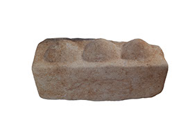
A small sanctuary, Building 5, was excavated south of the agora during the 2008 season. The small temple-like structure contained several figurines and incense burners. An altar was discovered on its eastern side in front of the entrance. In addition, a large marble stone was found here with three protrusions on its upper side. Several more of these stones were found elsewhere in the city and in the region. They may have served as dedications or played a role in the liturgy.
Building 10
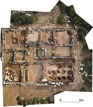
From 2007-2013 the team excavated Building 10, a large domestic structure.
Building 10 measures approximately 20m by 15m and was constructed with limestone foundation blocks and a mud brick superstructure with two stories. In various places the walls were covered with plaster painted in a variety of bright colours. The building could be entered from an alley located at the building’s eastern side. Two building phases have been distinguished.
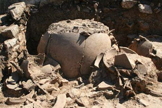
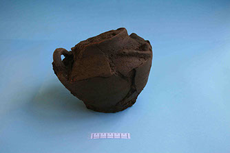
A minimum of 10 rooms surround an originally open area containing a basin and peristyle. In a later building stage this area was divided into two smaller and covered areas. A large room in the north-west area appears to be a main living area. It contained a central hearth. Within the hearth a pot was found which was decorated with a snake. It was filled with the burnt bone fragments. This find may represent a sacrifice, likely an offering to Zeus Ktesios. East of the large room is a smaller room finished with a waterproof plaster floor which may indicate a possible use as a bathroom. A large deposit of loom weights and perfume bottles were also found here.
Based on the artefacts found in this structure we date we conclude that ithe structure was used for domestic purposes and was inhabited during the late 3rd to the mid 2nd century BCE. The artefacts and architecture displayed considerable affluence. The accumulation of wealth may have had a strong agricultural base, indicated by the unusually high number of loom weights, the large number of grinding stones and an unprecedented high number of large storage vessels.
