On this page you can download an unpublished first draft version of the ClimateSA software and climate database, comprising approximately 3,000 climate grids at 30 arcsec (~1 km) and 1 arcmin (~2 km) resolution for historical climate (1901-2020) in monthly, annual, decadal, and 30-year steps and projected future climate (2020s, 2050s, 2080s) based on CMIP6 multi-model projections.
The database includes 48 monthly base variables (Tmin, Tmax, Tave & Prec) as well as 32 bioclim variables that have economic or biological relevance, such as growing and chilling degree days, heating and cooling degree days, Hargrave's climate moisture deficit and reference evaporation, and seasonal variables.
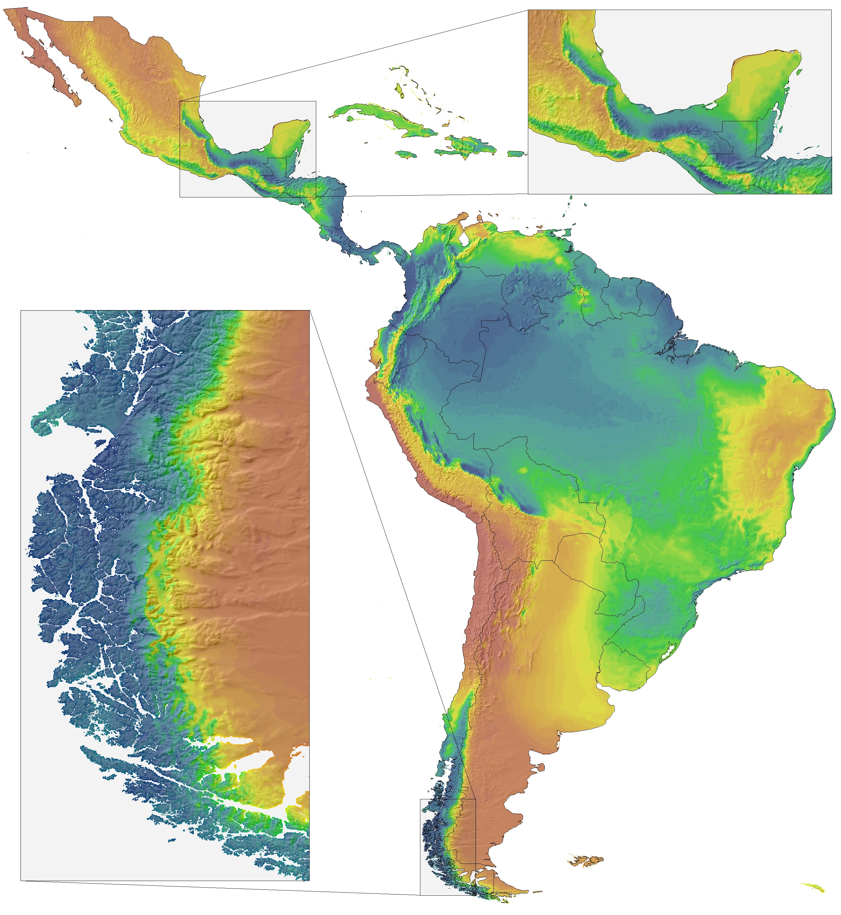
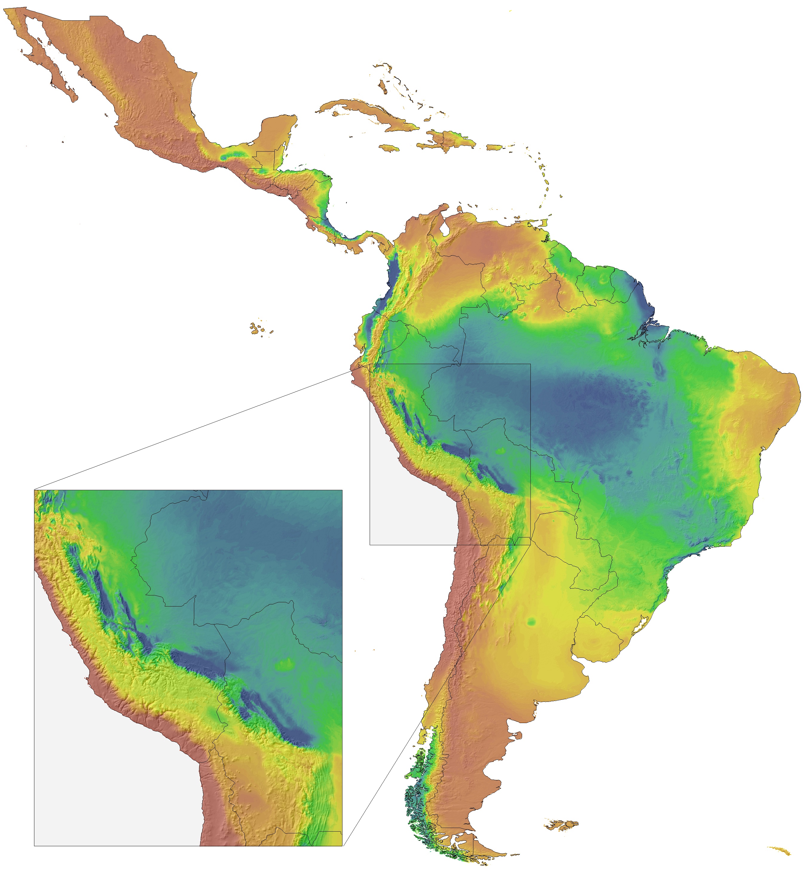
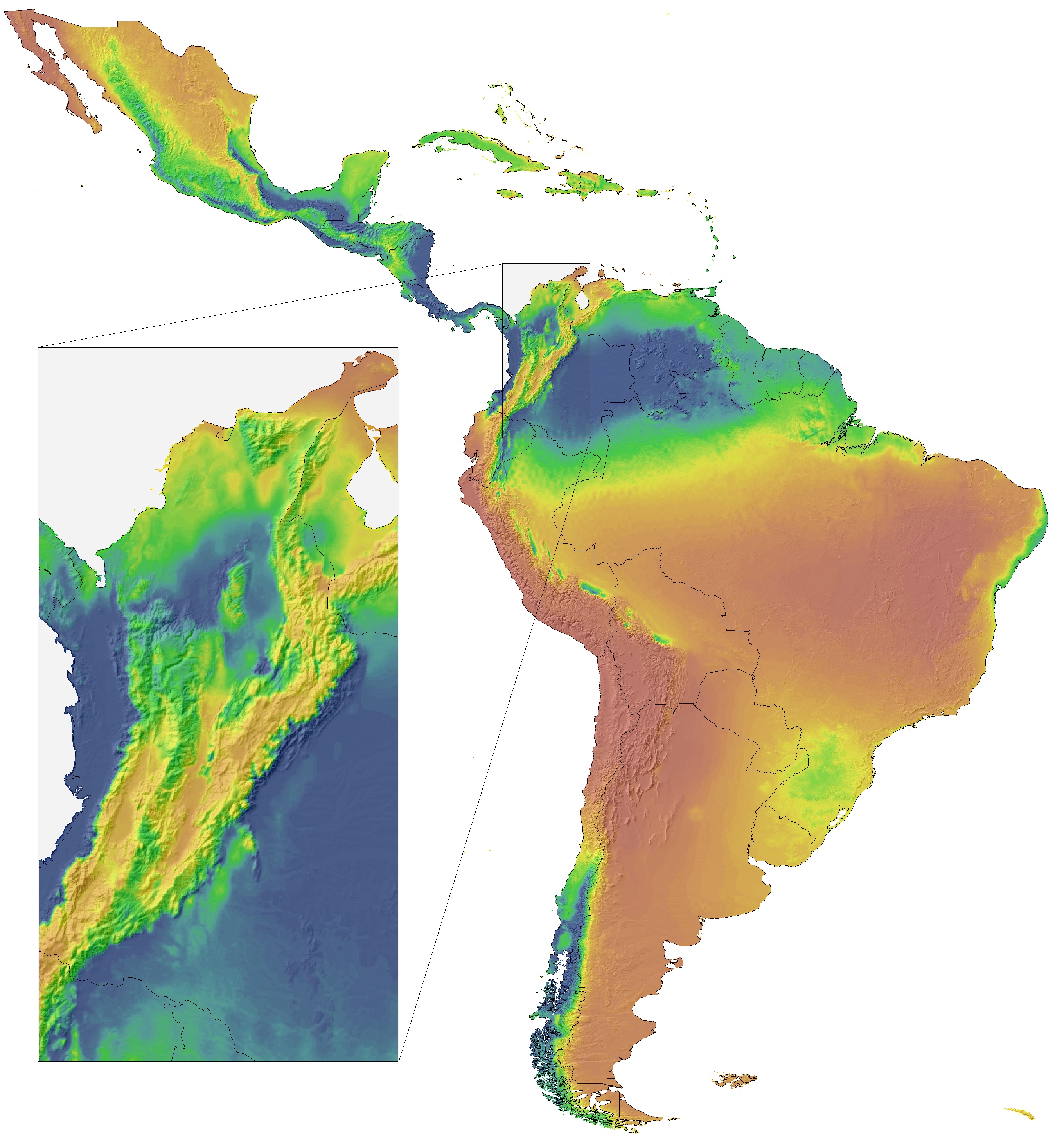
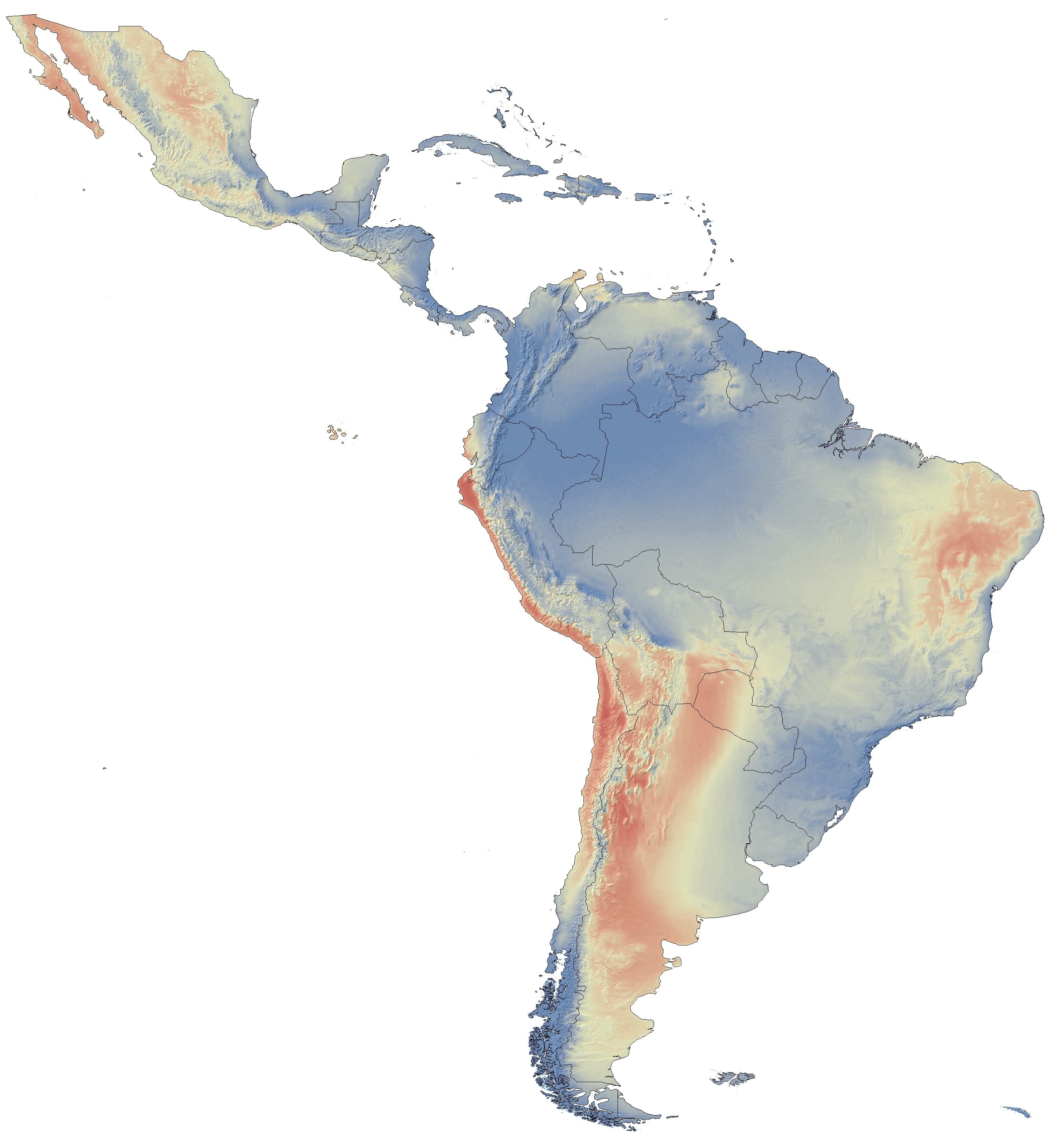
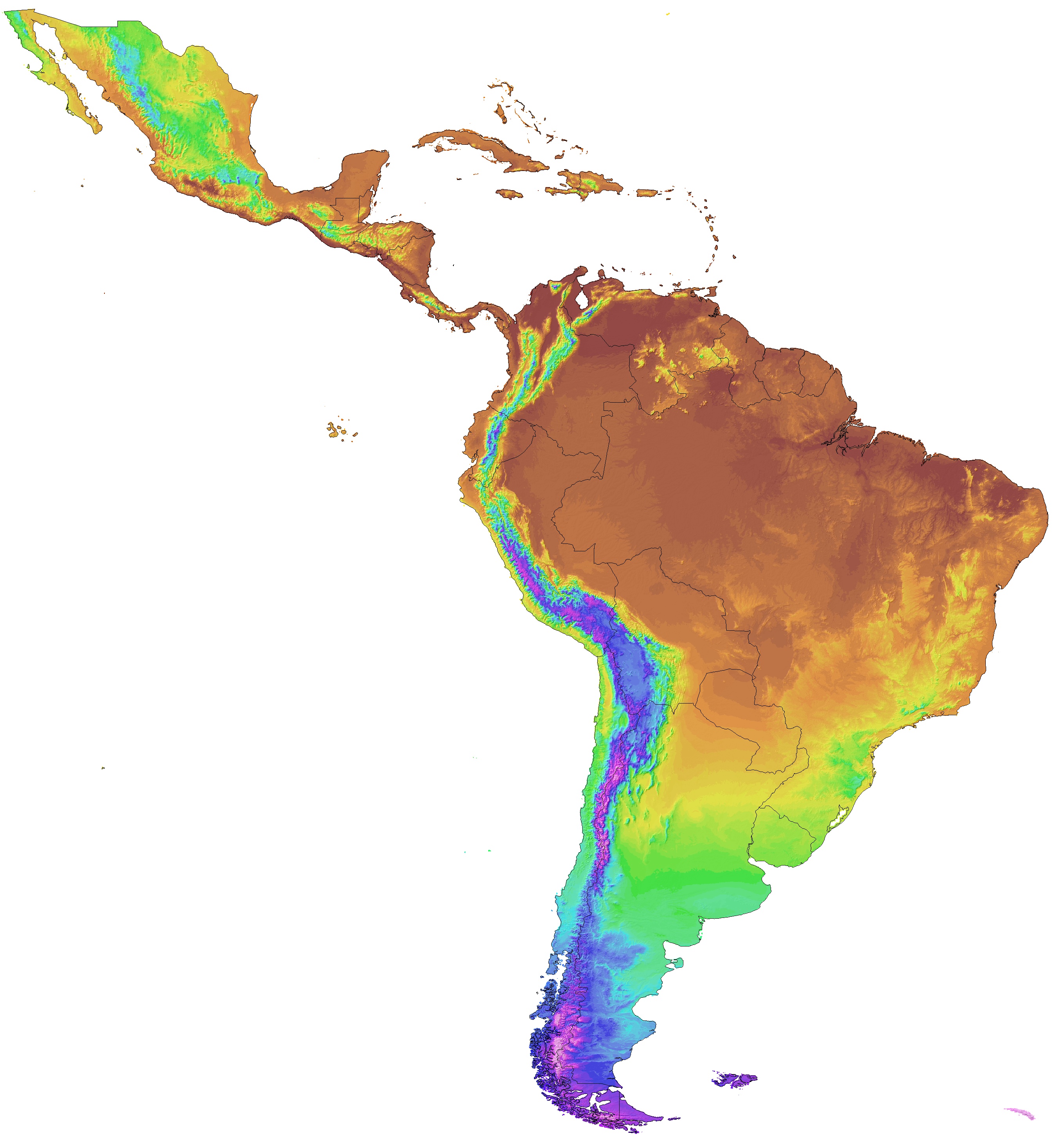
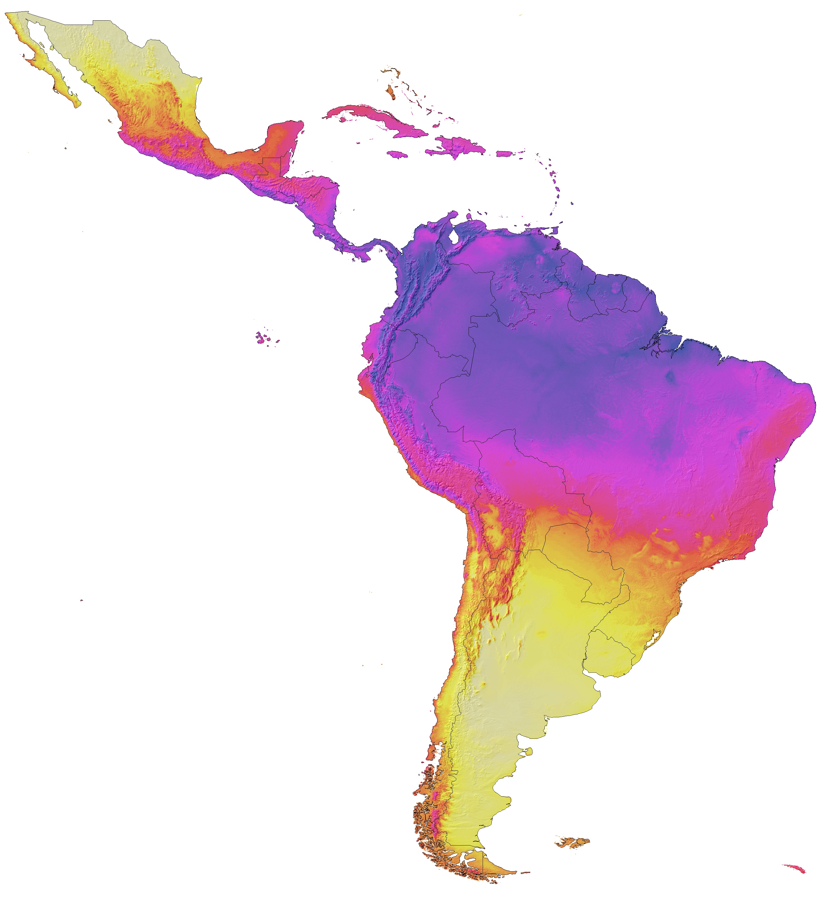
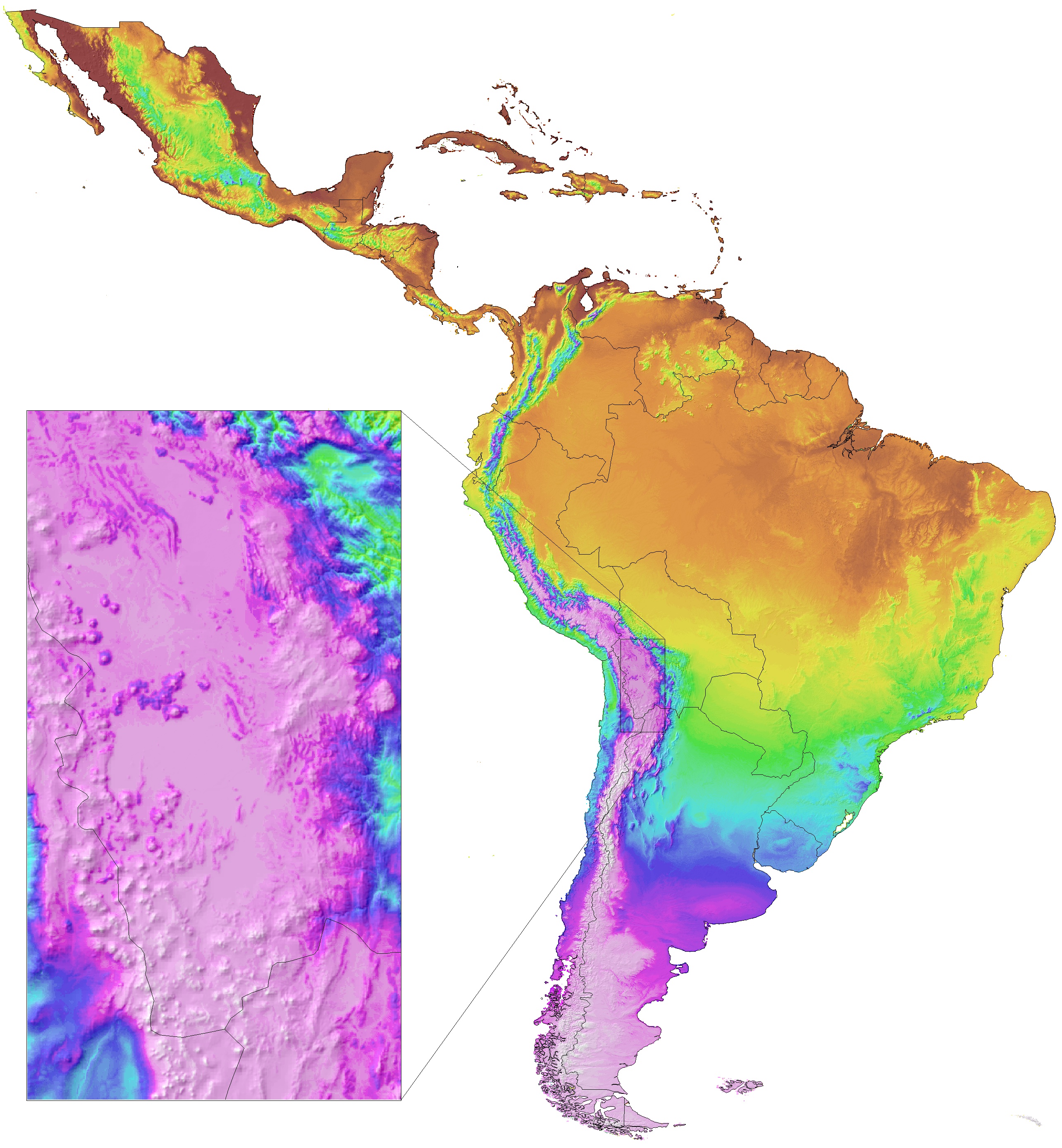
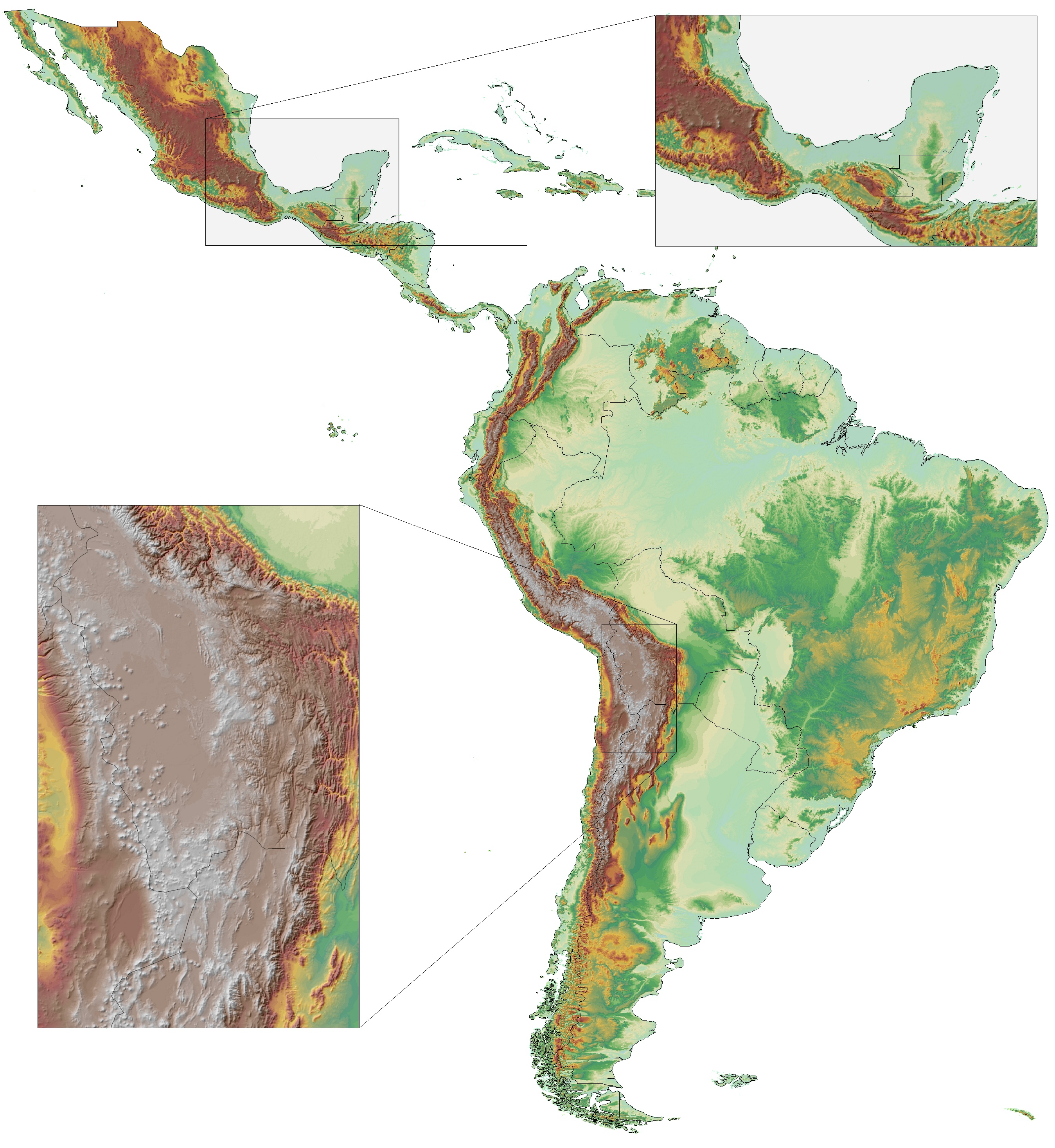
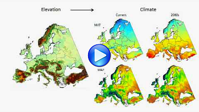
The climate grids were developed with a deep neural network that uses geographic and atmospheric information to model local weather patterns at medium resolution (e.g. see examples below, with the inset showing temperature inversions on high plateaus, and precipitation induced by orographic lift on the windward side, and rain shadows on the leeward side of major mountain ranges).
Subsequently, the ClimateSA software downscales the grids to higher resolutions with a digital elevation model in conjunction with local environmental lapse-rates. The software can also provide scale-free point estimates of climate variables for user-provided latitude, longitude and elevation coordinates.
Data downloads at 30 arcsec (~1 km) and 1 arcmin (~2 km) resolution are available from the tables below, but you may also visually explore some sample grids: click on a thumbnails below and then zoom in or out of different areas ( ![]() ), or view the RGB-GeoTIFFs in GIS.
), or view the RGB-GeoTIFFs in GIS.
| Mean Annual Precipitation (View, GIS) | Precipitation Dec-Jan-Feb (View, GIS) | Precipitation Jun-Jul-Aug (View, GIS) | Climate Moisture Deficit (View, GIS) |
 |
 |
 |
 |
| Mean Annual Temperature (View, GIS) | MWMT-MCMT Difference (View, GIS) | Mean Coldest Month Temp (View, GIS) | Reference Elevation Grid (View, GIS) |
 |
 |
 |
 |
ClimateSA software download and references
This program does not require installation. Download, unzip, and double click the executable file ClimateSA.exe. The program should run on all versions of Windows. If you receive the error message "COMCTL32.OCX missing", you have to install these libraryfiles. The program also runs on Linux, Unix and Mac systems with the free software Wine or MacPorts/Wine).

Note that the ClimateSA package and the grids downloadable below are not yet finalized and have not undergone peer-review. We are now collecting additional regional station data as well as feedback and comments from experts and users. We plan to release version 2.00 with improvements and corrections early 2026. Email ahamann@ualberta.ca if you like to be notified for the next release or if you have comments or suggestions.
That said, the data in its current form should already be fit for research purposes. You can use it and reference it like this: "Climate data has been generated with the ClimateSA v1.99 software package, available at http://tinyurl.com/ClimateSA, based on methodology described by Namiiro et al. (2025) and Mahoney et al. (2022)."


Video tutorials
Get started with these two video-tutorials. This first video (6 min for the ClimateAF package) introduces the data and methods and demonstrates the main functionality of the software. The second video (30 min, for the ClimateEU package) explains in detail how to generate gridded data.

Gridded data at 1 arcminute (~2 km) & 30 arcsecond (~1km) resolution
This dataset was created with the ClimateSA v1.99 software package for historical and projected 30-year normal periods. To generate additional projections for individual GCMs, you can use the "ClimateSA input file" with the "Grid generator R code", included in the help file below. The download packages of historical and projected climate data contain geoTIFF files compatible with most GIS applications in the standard WGS84 geographic (= EPSG:4326) projection. See the help file for further details and explanations:
1 arcmin (~2km) resolution download:
Help file |
ClimateSA input file |
Elevation, ID reference |
Area covered |
|---|---|---|---|
| Usage, variables, grid generator: |
1 arcmin CSV: |
1 arcmin geoTIFF: |
Shapefile: |
1 arcmin Historical 30-year climate normal periods |
|||
|---|---|---|---|
| 1940s (1931-1960) Bioclim: |
1950s (1941-1970) Bioclim: |
1960s (1951-1980) Bioclim: |
|
| 1970s (1961-1990) Bioclim: |
1980s (1971-2000) Bioclim: |
1990s (1981-2010) Bioclim: |
|
| 2000s (1991-2020) Bioclim: | (as a representation of current climate use the SSP2-2020s* projection below) | ||
Average ensemble scenarios1 |
32 Bioclimatic variables |
48 Monthly variables |
SSP1 (+2.6 W/m2) - Sustainability focus2 | 2020s3: |
2020s: |
|---|---|---|
| SSP2 (+4.5 W/m2) - Middle of the road | 2020s*: |
2020s*: |
| SSP3 (+7.0 W/m2) - Regional rivalry | 2020s: |
2020s: |
| SSP5 (+8.5 W/m2) - Fossil-fuel focus | 2020s: |
2020s: |
based on a variety of quality criteria and representativeness. For details on GCM selection, see Mahoney et al. (2022).
2) Average projected global warming by the 2080s for different Shared Socioeconomic Pathways (SSP) scenarios:
SSP1-2.6: 1.5-2.0°C; SSP2-4.5: 2.5-3.0°C; SSP3-7.0: 3.5-4.0°C; SSP5-5.8: 4.0-5.0°C.
3) Projections for 30-year normal periods: 2020s: 2011-2040, 2050s: 2041-2070, 2080s: 2071-2100.
*) SSP2-2020s is a good choice to represent current climate (midpoint of "middle of the road" climate normal estimate).
30 arcsec (~1km) resolution download:
Help file |
ClimateSA input file |
Elevation, ID reference |
Area covered |
|---|---|---|---|
| Usage, variables, grid generator: |
30 arcsec CSV: |
30 arcsec geoTIFF: |
Shapefile: |
30 arcsec Historical 30-year climate normal periods |
|||
|---|---|---|---|
| 1940s (1931-1960) Bioclim: |
1950s (1941-1970) Bioclim: |
1960s (1951-1980) Bioclim: |
|
| 1970s (1961-1990) Bioclim: |
1980s (1971-2000) Bioclim: |
1990s (1981-2010) Bioclim: |
|
| 2000s (1991-2020) Bioclim: | (as a representation of current climate use the SSP2-2020s* projection below) | ||
Average ensemble scenarios1 |
32 Bioclimatic variables |
48 Monthly variables |
SSP1 (+2.6 W/m2) - Sustainability focus2 | 2020s3: |
2020s: |
|---|---|---|
| SSP2 (+4.5 W/m2) - Middle of the road | 2020s*: |
2020s*: |
| SSP3 (+7.0 W/m2) - Regional rivalry | 2020s: |
2020s: |
| SSP5 (+8.5 W/m2) - Fossil-fuel focus | 2020s: |
2020s: |